Local Geology
by Bob Carson
Whitman College is situated on the eastern Columbia Plateau, site of some of the most catastrophic events in earth history: enormous basaltic lava flows 15 million years ago and giant jökulhlaups (glacier outburst floods) 15 thousand years ago. These and related events shaped the landscape of eastern Washington, where the Earth's youngest basalt plateau was swept by the largest documented floods in geologic history.
The Columbia Plateau is a physiographic province, part of a continent with somewhat similar rocks, landforms, soils, climate, and vegetation. The rocks are mostly basalt; the landforms are chiefly caused by erosion and deposition by jökulhlaups, but also by

streams and the wind; the soils are thick on loess (windblown silt) and immature to non-existent on sand, gravel, and basalt; the climate is arid (with as little as 20 cm annual precipitation); the natural vegetation is sagebrush shrubland and short-grass prairie.
The Columbia Plateau is bordered on the north and east by the Rocky Mountains, the south by the Basin and Range Province, and the west by the Cascades. The province is divided into several physiographic sections: Whitman College is in the southeastern part of the Walla Walla Plateau section, adjacent to the northwest flank of the Blue Mountains section. On the Walla Walla Plateau, two of the largest rivers in North America meet: the Snake River which originates in Jackson Hole, Wyoming, and the Columbia River which starts in the Columbia Icefields of the Canadian Rockies.

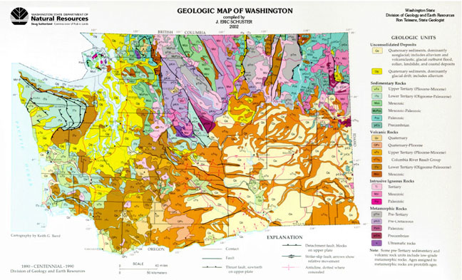
In the Blue Mountains are a wide variety of Phanerozoic rocks, predominantly late Paleozoic - early Mesozoic exotic terranes, late Mesozoic granitic intrusives, and Tertiary volcanics. Most of the Miocene basalt flows, which total as much as 3 km thick in the Walla Walla Plateau section, originated in the Blue Mountains, where there are long dikes. Click on map to view or download from Department of Natural Resources
The Columbia River Basalt Group covers an area of about 2 x 10⁵ km2 and has an estimated volume of 2 x 10⁶ km3 (Swanson and Wright, 1978). More than 99% of the basalt was erupted between 16.5 -14 m.y. ago. Eruptions occurred less often between 14 and 6 x 10⁶ years B.P. Concurrent with volcanism were subsidence (e.g., the Pasco Basin), deformation (e.g., the Yakima fold belt), erosion by rivers (many of the valleys were later filled by intracanyon flows), and sedimentation (e.g., the Ellensburg Formation). The north-south oriented compressional stress regime of south-central Washington has existed from the Miocene to present. Some anticlines in the Yakima fold belt have developed as much as 1000 m of structural relief in the past 10 m.y. (Reidel et al., 1992).
The major tectonic element in southeastern Washington is the northwest-trending Olympic-Wallowa lineament (OWL). It is in part a strike-slip fault, and is aligned with many of the anticlines of the Yakima fold belt (Tolan and Reidel, 1989). Most of the Yakima fold belt structures plunge to the east and die out in central Washington, but the Horse Heaven Hills anticline continues east across southern Washington and intersects the larger Blue Mountains anticline in northern Oregon. Between the Columbia River and the Blue Mountains, the OWL is formed by a 200-m high escarpment that marks the trace of the Wallula fault zone, a series of high-angle en echelon faults that display evidence for both dip-slip and strike-slip motion.
The Hite fault intersects the Olympic-Wallowa lineament at approximately a right angle 35 km southeast of Walla Walla. This northeasterly-striking fault disappears near Lower Granite Dam on the Snake River (Tolan and Reidel, 1989). The Walla Walla area experienced an intensity VII (approximately magnitude 6) earthquake on July 15, 1936 (Brown, 1937). The earthquake and its aftershocks may have been caused by movement on the Wallula fault zone and/or the Hite fault.
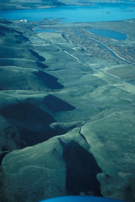
Although volcanism ceased on the Columbia Plateau, tectonism continued, and the Quaternary brought a new group of processes. In the Pasco Basin were many sources for wind-blown detritus: the Miocene Ellensburg Formation, the Pliocene Ringold Formation, and sediment deposited by the Columbia and Snake Rivers. The sediment load of these rivers was augmented during the glaciations of the Pleistocene; glaciers grew and shrank in the Cascades to the west, British Columbia to the north, the Rockies to the east, and the Wallowa and Elkhorn Mountains to the southeast. The prevailing southwesterly winds transported silt from the Pasco Basin; the silt became the thick loess in the Palouse Hills. Buried soils in the Palouse Formation indicate that loess deposition was intermittent during the Quaternary (Busacca, 1991).
The Cordilleran Ice Sheet originated in the mountains of British Columbia and expanded southward into northern Washington, Idaho, and Montana. Of particular significance to the landscape of eastern Washington was a lobe of the Cordilleran Ice Sheet which flowed along the Purcell Trench and blocked northwest-flowing Clark Fork River near Cabinet Gorge on the Idaho-Montana border.
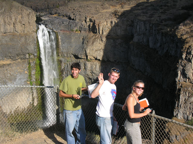
The ice dammed Glacial Lake Missoula (Pardee, 1910), which covered 7800 km2 of western Montana and held 2000 km2 of water; at the ice dam the water was approximately 600 m deep (Weis and Newman, 1989). The ice dam failed repeatedly, releasing jökulhlaups which swept across northern Idaho, through Spokane, southwestward across eastern Washington, through the Columbia River Gorge, and out into the Pacific Ocean. In eastern Washington the floods created the Channeled Scablands, an area of intense study by J Harlen Bretz in the 1920s (Baker and Nummedal, 1978).
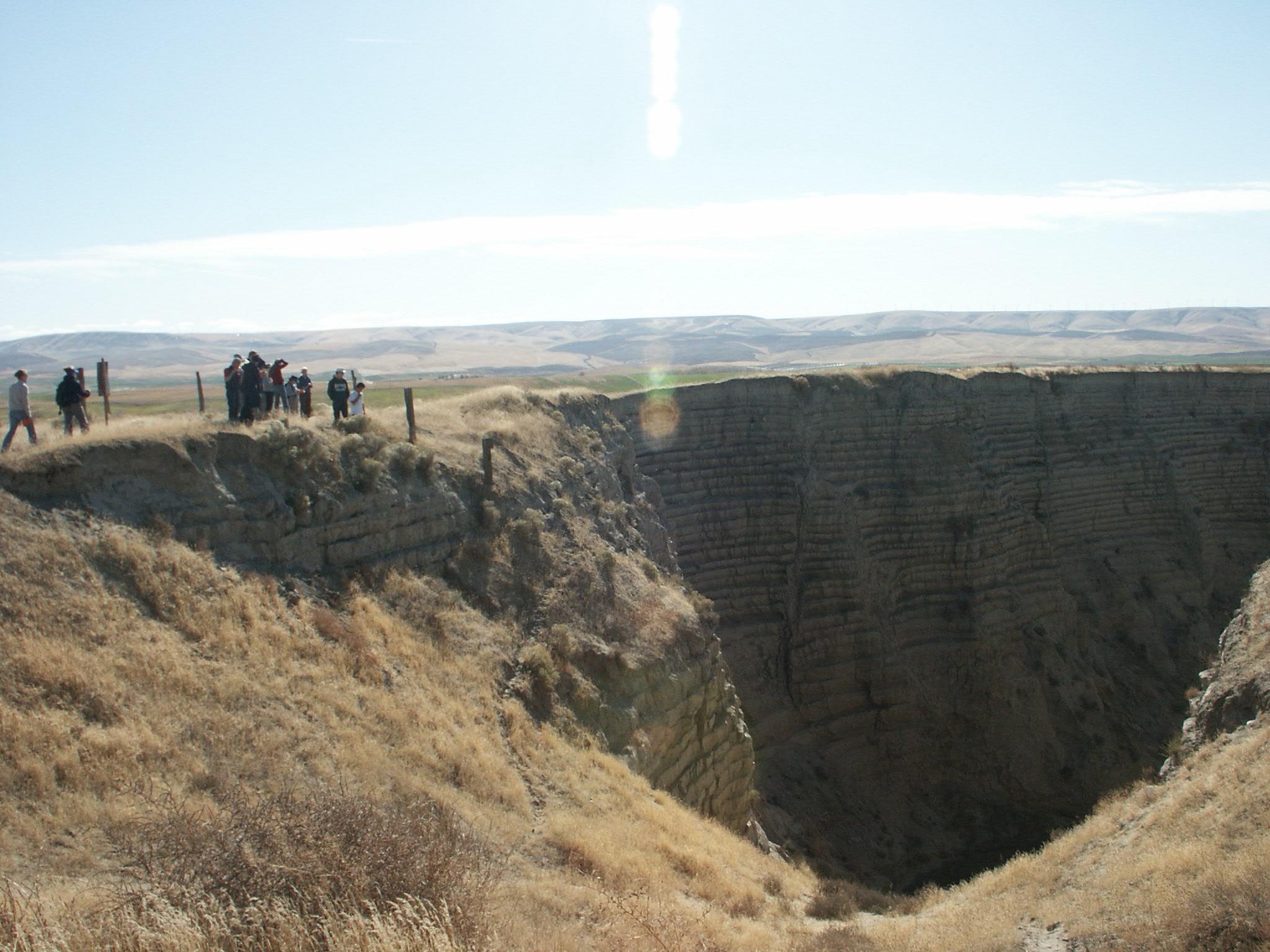
In general where water velocities were highest the Missoula floods eroded channels, many with scour depressions, and left scabs or erosion remnants of basalt - hence the name Channeled Scablands for eastern Washington. Where the floods slowed down a little, such as in eddies, giant gravel bars were deposited; the Pasco gravels were transported as bed load and contain many lithologies that are not Columbia River basalts. Where the floods ponded, for example in the Walla Walla Valley, relatively fine-grained slackwater sediments were deposited (Bretz, 1928); these graded rhythmites are called the Touchet beds (Flint, 1938). Large icebergs rode the jökulhlaups and left erratic boulders along the main route of the floods and far up tributary valleys.
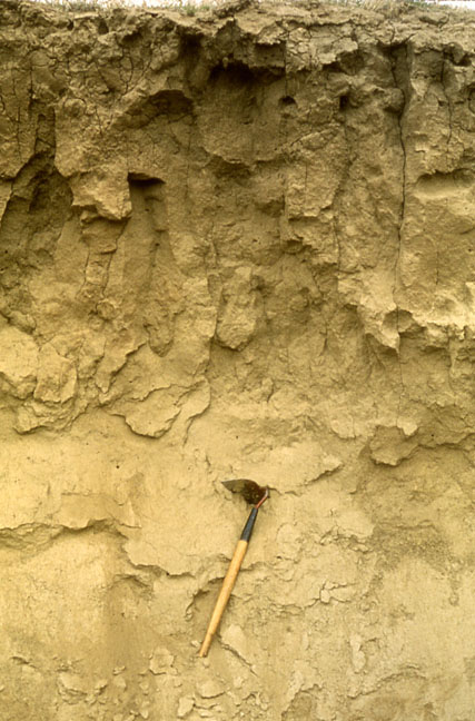
Waitt (1980) argued that each of about 40 Touchet beds resulted from a separate catastrophic flood. These floods could only occur when glacial Lake Missoula existed, which Waitt (1985) estimates at 15,300 to 12,700 years B.P. Mt. St. Helens "S" ash fell in eastern Washington about 13,000 years B.P. and is ten rhythmites below the top of the Touchet beds (Waitt, 1980). After each jökulhlaup swept through Spokane, much of the floodwater dumped into Glacial Lake Columbia at the northern edge of the Columbia Plateau (Atwater, 1984). This lake formed when the Columbia River was blocked at the present site of Grand Coulee Dam by the Okanogan Lobe of the Cordilleran Ice Sheet. Atwater (1984) counted flood deposits and varves which accumulated in Glacial Lake Columbia and determined that the interval between Missoula floods was 35 to 55 years.
During the Holocene, the collapse of Mt. Mazama about 6845 years B.P. to form Crater Lake showered southeastern Washington with Mazama tephra (Bacon, 1983). About a meter of loess blanketed the area, and dunes migrated downwind from major rivers until modern dams made reservoirs that drowned the sand supply. Intense agricultural activity has resulted in extreme erosion of the fine-grained soils.
Atwater, B.F., 1984, Periodic floods from glacial Lake Missoula into the Sanpoil arm of glacial Lake Columbia, northeastern Washington: Geology, v. 12, p. 464-467.
Bacon, C.R., 1983, Eruptive history of Mount Mazama and Crater Lake caldera, Cascade Range, U.S.A.: Journal of Volcanology and Geothermal Research, v. 18, p. 57-115.
Baker, V.R., and Dag Nummedal, eds., 1978, The Channeled Scabland (a guide to the geomorphology of the Columbia Basin, Washington): National Aeronautics and Space Administration, 186 p.
Busacca, A. J., 1991, Loess deposits and soils of the Palouse and vicinity, in V. R. Baker, B. N. Bjornstad, and others, Quaternary geology of the Columbia Plateau, in R. B. Morrison, ed., Quaternary nonglacial geology - conterminous U.S.: Geol. Soc. America DNAG Geology of North America, v. K-2, p. 216-228.
Bretz, J H., 1928, Alternative hypotheses for Channeled Scabland I, II: Journal of Geology, v. 36, p. 193-223, 312-341.
Brown, B.H., 1937, The State-Line earthquake at Milton and Walla Walla: Seismol. Soc. Am. Bull., v. 237, p. 205-209.
Carson, R.J., ed., 2008, Where the great river bends: A natural and human history of the Columbia at Wallula: Sandpoint, Idaho: Keokee Books, p. 220.
Carson, R.J., and K.R. Pogue, 1996, Flood basalts and glacier floods: Roadside geology of parts of Walla Walla, Franklin, and Columbia Counties, Washington: Washington Division of Geology and Earth Resources Information Circular 90, p. 47.
Carson, R.J., and S. Babcock, 2009, Hiking guide to Washington geology: Sandpoint, ID, Keokee Books (reprint of Babcock and Carson, 2000).
Flint, R.F., 1938, Origin of the Cheney-Palouse Scabland Tract, Washington: Bull. Geol. Soc. America, v. 49, p. 461-524.
Pardee, J.T., 1910, The Glacial Lake Missoula: Journal of Geology, v. 18, p. 376-386.
Reidel, S.P., K.R. Fecht, and K.A. Lindsey, 1992, Post-Columbia River basalt structure and stratigraphy of south-central Washington: Geol. Soc. America Abstracts with Programs, v. 24, no. 5, p. 78.
Swanson, D.A., and T.L. Wright, 1978, Bedrock geology of the northern Columbia Plateau and adjacent areas, in V.R. Baker and Dag Nummedal, eds., the Channeled Scabland (a guide to the geomorphology of the Columbia Basin, Washington): National Aeornautics and Space Administration, p. 37-57.
Tolan, T.L., and S.P. Reidel, 1989, Structure map of a portion of the Columbia River flood-basalt province, in S.P. Reidel and P.R. Hooper, eds., Volcanism and tectonism in the Columbia River flood-basalt province: Geol. Soc. America Special Paper 239.
Waitt, R.B., 1980, About forty last-glacial Lake Missoula jökulhlaups through southern Washington: Jour. Geology, v. 88, p. 653-679.
Waitt, R.B., 1985, Case for periodic, colossal jökulhlaups from Pleistocene glacial Lake Missoula: Geol. Soc. America Bull., v. 96, p. 1271-1286.
Weis, P.L., and W.L. Newman, 1989, The Channeled Scablands of eastern Washington - The geologic story of the Spokane Flood: Eastern Washington University Press, Cheney, 25.
